
Mapping a drainage system is a critical task for municipalities aiming to improve stormwater management, identify illicit discharges, support maintenance planning, and ensure regulatory compliance (e.g., MS4). A well-structured drainage system map reveals how stormwater flows through catch basins, pipes, culverts, channels, and outfalls, forming the backbone of effective stormwater asset management.
If your municipality falls within the jurisdiction of a Soil and Water Conservation District (SWCD), it’s highly recommended that you contact your local district office before beginning a new drainage mapping effort. Many SWCDs have already conducted comprehensive stormwater assessments and may possess valuable data on critical facilities such as culverts, outfalls, and drainage basins. They can provide guidance, existing maps, and possibly even GIS files or survey records that can save your team time and resources. In many cases, partnering with your SWCD ensures your mapping efforts align with regional watershed priorities and state reporting requirements.
Before you begin mapping, clarify:
What types of features you need to include (e.g., manholes, culverts, storm drains, open channels, outfalls)
Why you're creating the map (e.g., compliance, maintenance, modeling, flood prevention)
Who will use it (e.g., public works crews, engineers, planners)
A well-scoped project helps prioritize resources and data accuracy.
Collect all available resources that may inform your base map:
As-built drawings
Site or subdivision plans
GIS shapefiles
Maintenance records
Aerial imagery
LiDAR elevation data
Parcel or utility maps
Many cities store this data in local or state-level GIS repositories or public works archives.
Reference:
U.S. EPA MS4 Mapping Guidance: https://www.epa.gov/npdes/stormwater-maps-and-tools
FEMA GIS Resources: https://www.fema.gov/gis
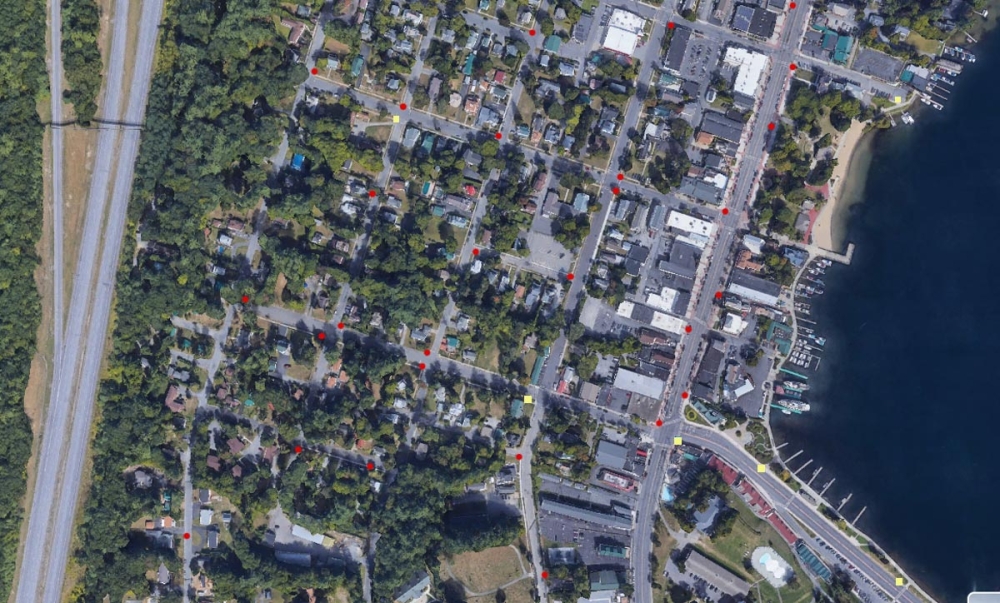
Because existing maps are often outdated or incomplete, field validation is essential. Equip your team with:
GPS-enabled data collectors or smartphones with GNSS accuracy
Asset ID system to track components
Photo documentation
Survey key stormwater features:
Catch basins and inlets
Pipes (with diameter, material, flow direction)
Manholes
Headwalls
Detention basins and BMPs
Outfalls (especially priority for MS4)
Tip: Use consistent attribute fields and naming conventions. Many municipalities follow the NASSCO or EPA standards for asset data.
Reference:
ESRI Field Data Collection Guide: https://www.esri.com/en-us/field-operations
Use GIS software (such as ArcGIS, QGIS, or a stormwater-specific platform) to digitize the system:
Layer structure: Separate layers for basins, pipes, outfalls, and surface flow
Topology rules: Ensure connected flow (e.g., no dangling pipes)
Symbology: Apply standard symbology for ease of interpretation
QGIS and ArcGIS both offer templates and plugins for utility mapping.
Reference:
QGIS Stormwater Plugins: https://plugins.qgis.org/
ArcGIS Utility Network Management: https://www.esri.com/en-us/arcgis/products/arcgis-utility-network
Overlay the infrastructure with elevation data (DEM/DTM) to model surface water flow:
Delineate watersheds and subcatchments
Determine flow direction and accumulation
Identify low-lying or flood-prone areas
Tools like HEC-HMS or EPA SWMM can enhance modeling efforts when combined with your GIS map.
Reference:
EPA SWMM: https://www.epa.gov/water-research/storm-water-management-model-swmm
USGS National Map Elevation Data: https://apps.nationalmap.gov/downloader
A drainage map should evolve over time. Be sure to:
Version control: Archive historical versions of the map
Update after new construction or repairs
Link assets to inspection and maintenance records
Some municipalities integrate drainage maps into asset management systems or cloud-based field apps to streamline upkeep.
Reference:
NACTO Urban Street Stormwater Guide: https://nacto.org/publication/urban-street-stormwater-guide/
FHWA Hydraulic Engineering Circulars (HECs): https://www.fhwa.dot.gov/engineering/hydraulics/library_arc.cfm
Creating a detailed, accurate drainage system map requires a coordinated effort across data collection, GIS work, field validation, and long-term maintenance. For municipalities, this map is more than just a record. It’s a tool for smarter decisions, cleaner water, and safer communities.