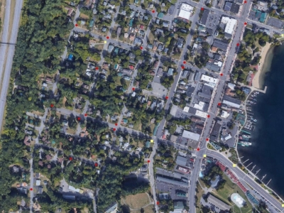
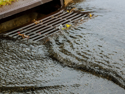
Articles Tagged: Geographic Information System

Training Field Crews to Support Asset Management Goals

Training Field Crews to Support Asset Management Goals

Training field crews to support asset management goals is one of the most overlooked, yet most impactful, steps a municipality can take when trying to build a reliable stormwater or roadway asset program. You can invest in the best software, develop detailed capital improvement plans, and establish …

continue
From Spreadsheets to Systems, Building Your First Stormwater Asset Inventory

From Spreadsheets to Systems, Building Your First Stormwater Asset Inventory

Building a stormwater asset inventory often begins in a very familiar place, a spreadsheet opened by someone who knows the system well enough to start writing things down. There is nothing wrong with that starting point. In fact, many successful asset management programs begin with a simple table of…

continue
What Is Stormwater Asset Management and Why It Matters More Than Ever

What Is Stormwater Asset Management and Why It Matters More Than Ever

Stormwater asset management is one of those concepts that sounds technical and abstract, yet at its core it is simply about knowing what you own, understanding its condition, and making informed decisions before problems turn into emergencies. For municipalities responsible for miles of pipe, hundre…

continue
Stormwater Outfall Data Requirements, What Must Be Recorded and Why It Matters

Stormwater Outfall Data Requirements, What Must Be Recorded and Why It Matters

A well managed stormwater program depends on accurate and complete information about every outfall in a community. Outfalls are the final discharge points where stormwater leaves the municipal system and enters a stream, lake, wetland, or other receiving water. Because these locations represent the …

continue
What Every MS4 Must Map, and Why It Matters for Waterway Protection

What Every MS4 Must Map, and Why It Matters for Waterway Protection

A complete and accurate stormwater map is one of the most important responsibilities for any community that operates as a Municipal Separate Storm Sewer System, or MS4. These maps are not created merely to satisfy a regulatory checkbox. They protect waterways, support field crews, reduce liability, …

continue
Free Mapping Tools for Communities with Limited Budgets

Free Mapping Tools for Communities with Limited Budgets

Several free or very low cost tools can help communities with limited budgets begin mapping or inventorying their stormwater infrastructure. These tools are not full replacements for a dedicated asset management system, but they can give small towns a head start and help them organize information be…

continue
Understanding MS4 Expectations for a Complete Stormwater Infrastructure Record

Understanding MS4 Expectations for a Complete Stormwater Infrastructure Record

Municipal Separate Storm Sewer System (MS4) permits rest on a simple idea: you cannot manage what you have not first documented. The Environmental Protection Agency (EPA) defines an MS4 as any publicly owned system of drains, pipes, ditches, or similar conveyances that carries runoff to waters of th…

continue
From Paper Plans to GIS: Digitizing Historic Drainage Records

From Paper Plans to GIS: Digitizing Historic Drainage Records

Every municipality owns drawers, or entire vaults, of ageing drainage “plan sets”: linen originals from the 1930s, blueprint mylars from the 1960s, contractor mark-ups from a 1998 sewer separation project, and everything in-between. Transforming those static sheets into a living GIS data…

continue
How to Create a Drainage System Map

How to Create a Drainage System Map

Mapping a drainage system is a critical task for municipalities aiming to improve stormwater management, identify illicit discharges, support maintenance planning, and ensure regulatory compliance (e.g., MS4). A well-structured drainage system map reveals how stormwater flows through catch basins, p…

continue
How to Map Municipal Drainage Systems: A Step-by-Step Guide for Local Governments

How to Map Municipal Drainage Systems: A Step-by-Step Guide for Local Governments

Municipal drainage systems are often out of sight and, unfortunately, out of mind. Yet, these underground networks are vital to public safety, environmental protection, and infrastructure longevity. Accurate mapping of stormwater infrastructure is not only a best practice - it’s an operational…

continue