

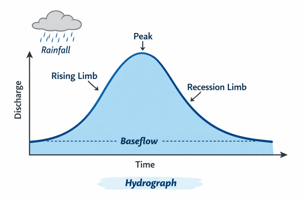
The rising limb is the portion of a hydrograph that represents the increase in streamflow or discharge from the onset of a precipitation event up to the point of peak discharge. It reflects how quickly water from rainfall or snowmelt is conveyed through a watershed and into a stream channel.
In stormwater management and hydrology, the rising limb begins when precipitation first produces measurable runoff at the watershed outlet. As rainfall continues, water reaches the stream through multiple pathways, including direct surface runoff, shallow subsurface flow, and contributions from impervious surfaces. The combined effect of these inputs causes streamflow to increase, often rapidly, producing the upward-sloping segment of the hydrograph.
The steepness and shape of the rising limb are controlled by watershed characteristics such as land use, slope, soil type, drainage network, and the extent of impervious cover. Urbanized watersheds with large areas of pavement and efficient storm drainage systems tend to exhibit a very steep rising limb, indicating a rapid hydrologic response and short lag time between rainfall and peak flow. In contrast, rural or forested watersheds with permeable soils and greater storage capacity typically have a more gradual rising limb, reflecting slower runoff generation and delayed delivery to the stream.
Rainfall characteristics also play a significant role. High-intensity storms can produce a sharp, steep rising limb due to rapid runoff generation, while low-intensity or prolonged rainfall may result in a more gradual increase in flow.
From a design and analysis perspective, the rising limb is important because it influences peak discharge, time of concentration, and flood risk. A steeper rising limb generally corresponds to higher peak flows and a greater potential for flash flooding, which must be accounted for in the design of stormwater infrastructure.
The rising limb is the ascending portion of a hydrograph that shows how streamflow increases in response to precipitation, governed by both watershed characteristics and storm intensity.