

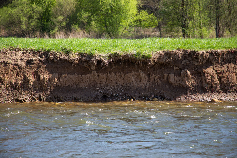
Stream erosion is the process by which flowing water removes, transports, and redistributes soil, sediment, rock, and other materials from the bed, banks, and surrounding areas of a stream, creek, river, ditch, or channel. It is a natural geomorphic process that shapes waterways over time, creating meanders, floodplains, pools, riffles, and valleys. However, human activities and changes in watershed hydrology can dramatically accelerate stream erosion, resulting in environmental damage, infrastructure failures, and degraded water quality.
Under natural conditions, streams exist in a state of dynamic equilibrium in which sediment entering a reach is roughly balanced by sediment leaving it. When this balance is disrupted, streams may begin eroding their beds, banks, or both in an attempt to regain stability. Excessive runoff volumes and higher flow velocities are among the most common causes of accelerated stream erosion in developed watersheds.
Stormwater runoff generated by impervious surfaces such as roads, rooftops, parking lots, and sidewalks often reaches streams more rapidly and in larger quantities than would occur under natural conditions. This increase in runoff volume and peak discharge can cause channels to enlarge, deepen, and widen over time. Even relatively frequent, moderate storms can become highly erosive when runoff is concentrated and delivered quickly to receiving waters.
Stream erosion generally occurs in three primary forms:
Bed erosion (downcutting or incision) occurs when flowing water removes material from the bottom of a channel, causing the stream to become deeper. This process can lower groundwater levels adjacent to the stream, disconnect the channel from its floodplain, expose utility crossings, undermine bridge foundations, and destabilize streambanks.
Bank erosion occurs when flowing water removes material from the sides of a channel. Bank erosion may be caused by high velocities, turbulence, undercutting, freeze-thaw cycles, wave action, or the loss of stabilizing vegetation. Severe bank erosion can result in property loss, fallen trees, sediment loading, and damage to roads, culverts, and other infrastructure.
Headcut erosion occurs when a sudden change in channel elevation creates a vertical drop or "headcut" that migrates upstream over time. Headcuts can rapidly destabilize channels, ditches, and drainage swales, often resulting in significant erosion and sediment transport.
Several factors influence the severity and rate of stream erosion, including stream velocity, flow volume, channel slope, soil type, bank material, vegetation cover, channel geometry, and the frequency and intensity of storm events. Streams with sandy or silty banks are generally more susceptible to erosion than streams with cohesive clay soils or exposed bedrock.
Common human activities that contribute to stream erosion include urbanization, deforestation, agricultural land clearing, channel straightening, removal of riparian vegetation, undersized culverts, concentrated stormwater discharges, and increased impervious cover within a watershed.
The consequences of excessive stream erosion can be significant. Eroded sediment can increase turbidity, bury aquatic habitat, transport attached pollutants such as phosphorus and heavy metals, and impair fish spawning areas. Infrastructure impacts may include damaged culverts, exposed pipelines, failed retaining walls, undermined roadways, and increased maintenance costs for municipalities and landowners.
Stormwater professionals use a variety of strategies to reduce and prevent stream erosion. These may include reducing runoff volumes through green infrastructure, restoring floodplain connectivity, dissipating flow energy, stabilizing streambanks with vegetation or engineered materials, protecting riparian buffers, and implementing upstream stormwater management practices such as detention basins, infiltration systems, bioswales, and constructed wetlands.
In stormwater management, stream erosion is considered one of the primary indicators of altered watershed hydrology and is often used as a measure of the long-term impacts of development on receiving waters.